Need Assistance?
+1-870-692-6050
Surveying
Elevate your surveying accuracy with Topcon's cutting-edge geopositioning technology, designed for precision in civil engineering, construction, and environmental studies.
WE Are An official dealer for topcon
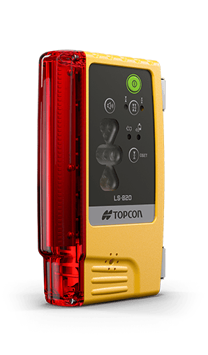
Robotic Total Stations: Experience unparalleled efficiency with our robotic total stations, featuring automated motorized technology for precise measurements of distances, angles, and coordinates. Ideal for reducing human error and enhancing data collection.
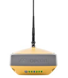
GNSS Receivers: Our GNSS receivers deliver highly accurate positioning data by utilizing signals from all available satellite systems. They ensure reliable performance even in the most challenging environments, supporting a wide range of surveying applications.
Scanning Solutions: For projects requiring comprehensive point clouds, our scanning solutions offer detailed evaluations of structures or digital plan comparisons. This technology is perfect for thorough surveys and as-built assessments.
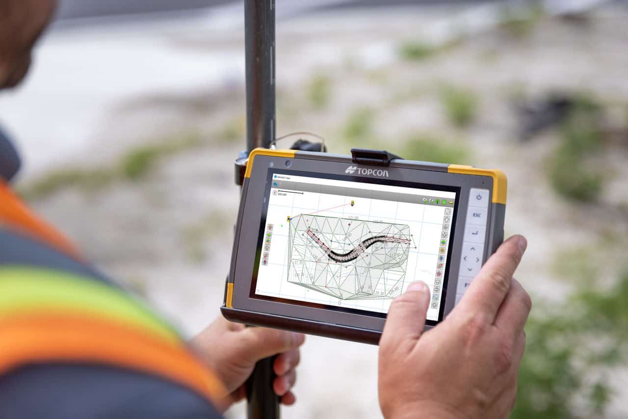
Software Solutions: Topcon provides innovative software solutions that integrate and analyze surveying data efficiently. Create detailed maps and 3D models for construction planning, environmental impact assessments, and more, with our advanced software.
Hybrid Positioning™ Technology: Our Hybrid Positioning™ technology merges GNSS positioning with optical robotic measurements, allowing for seamless switching between measurement modes. This adaptability is crucial for overcoming line-of-sight or satellite reception challenges on the job site.
Topnet Live Correction Services: With Topnet Live, enjoy high-precision accuracy for your survey, machine control, and more without the need for a base station. This global GNSS correction service streamlines project setups and ensures reliable accuracy across applications.
Testimonials
What Our Clients Say
 Aenean feugiat scelerisque ligula ut tincidunt. Cras bibendum posuere felis, sit amet pretium orci aliquam eu. Morbi tincidunt tellus at nulla fringilla, eget hendrerit odio sollicitudin.Jimmy Doe Customer
- Integer commodo vulputate tortor, sit amet posuere arcu facilisis sit amet. Morbi vitae leo malesuada, sagittis sapien sit amet, sodales arcu. Aenean odio arcu, efficitur at risus vitae, ullamcorper malesuada mauris.Jane Doe Customer
- Lorem ipsum dolor sit amet, consectetur adipiscing elit. Vivamus varius dui sed velit porttitor, eu pulvinar neque pulvinar. Quisque enim justo, tempus vel justo ut, consequat posuere diam.John Doe Customer
FAQS
Questions About Surveying?

From Crops to Concrete
Elevate Your Operations with Our Cutting-Edge Agriculture and Construction Tech
Contact Sales